Size of this preview: 692 × 599 pixels. Other resolution: 927 × 803 pixels.
Original file (927 × 803 pixels, file size: 132 KB, MIME type: image/jpeg)
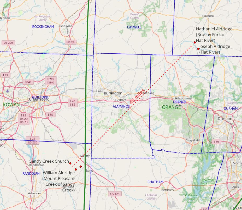
Map showing the land grants of William Alldredge on Sandy Creek, and Nathaniel Aldridge and Joseph Aldridge on the Flat River.
File history
Click on a date/time to view the file as it appeared at that time.
| Date/Time | Thumbnail | Dimensions | User | Comment | |
|---|---|---|---|---|---|
| current | 20:28, 15 July 2023 | | 927 × 803 (132 KB) | Joseph (talk | contribs) | Better base map. |
| 17:28, 3 July 2023 | 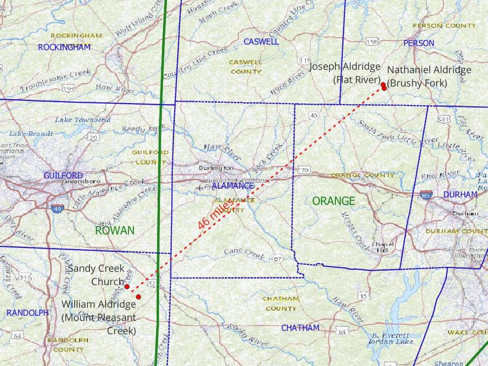 | 988 × 741 (202 KB) | WikiSysop (talk | contribs) |
You cannot overwrite this file.
File usage
The following 2 pages use this file: